Log in
All resources
Create a design
Tools
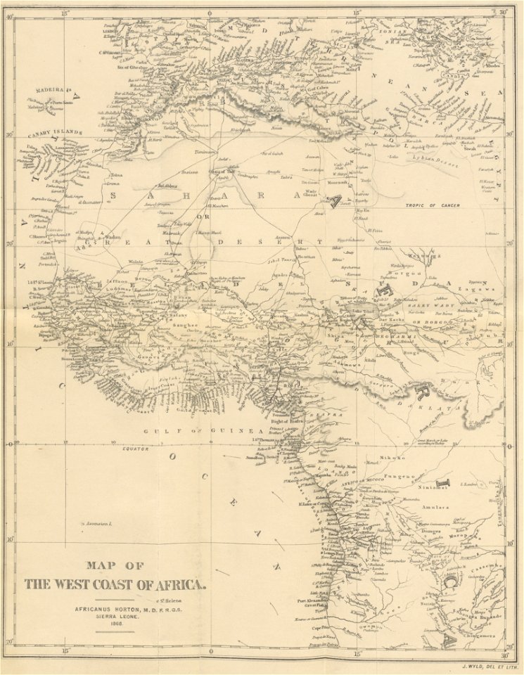
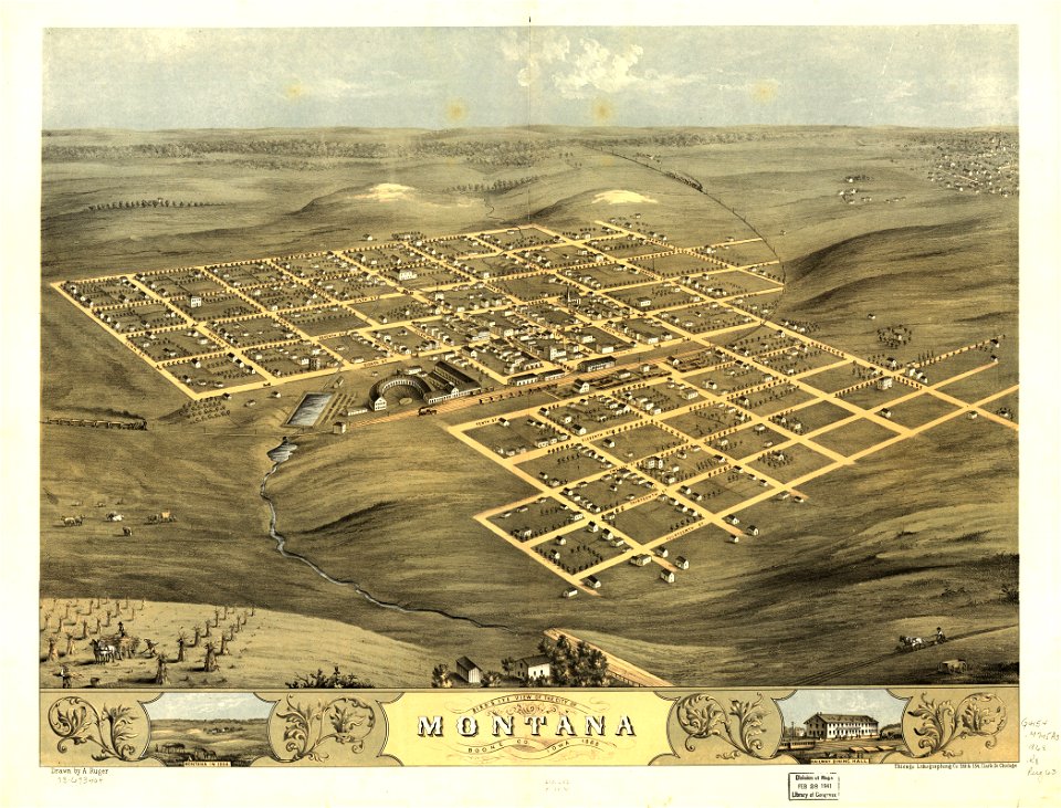
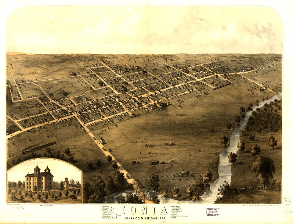
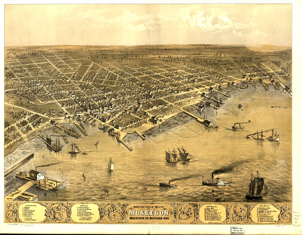
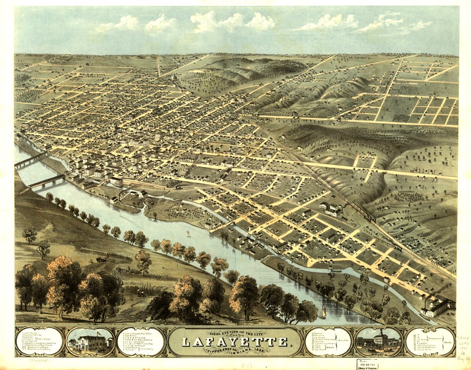
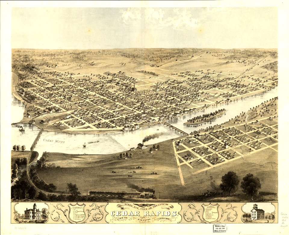
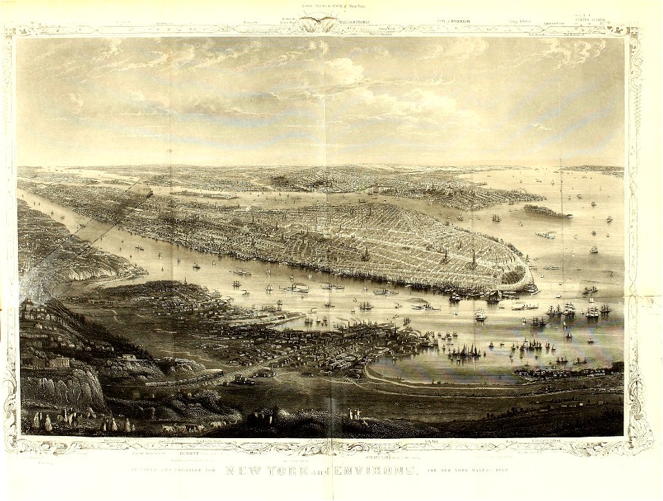
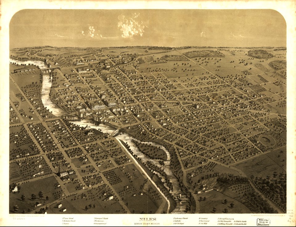
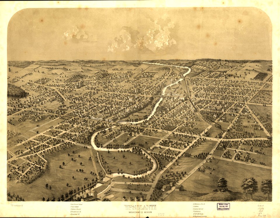
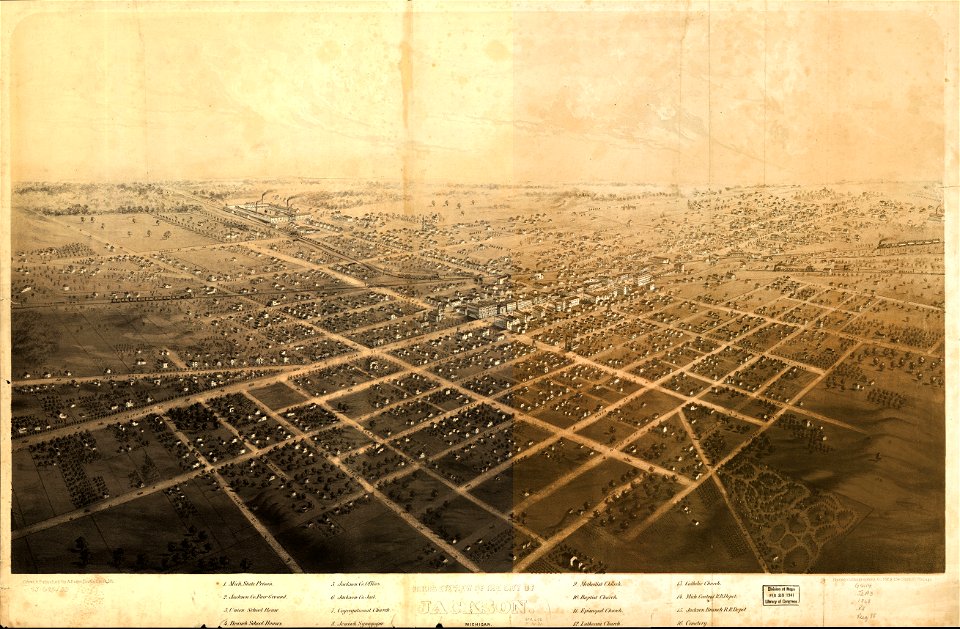
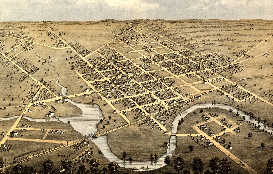
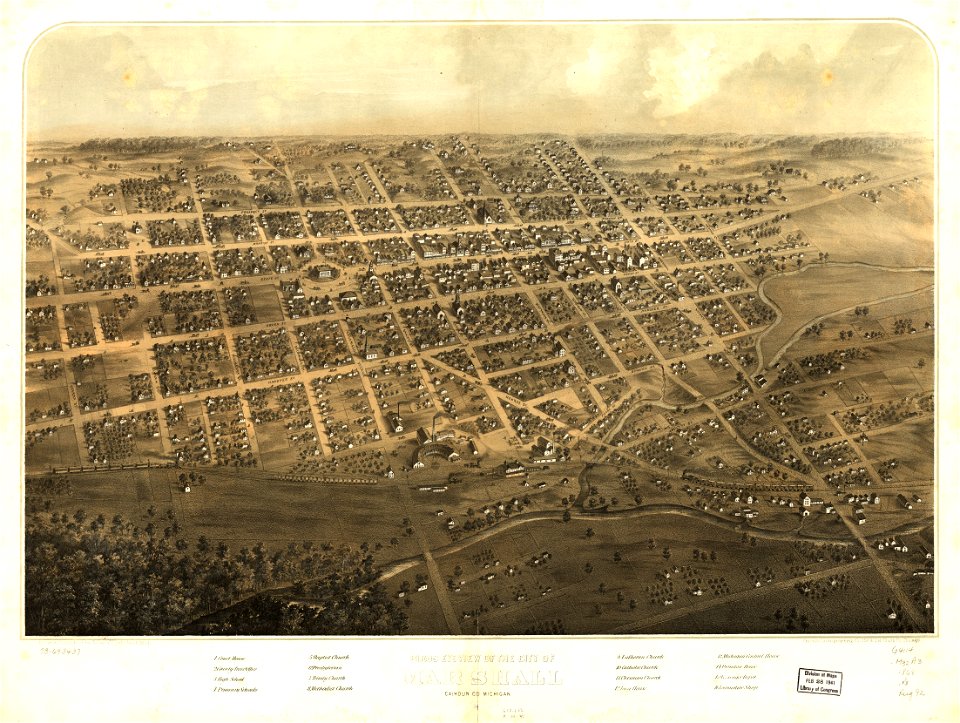
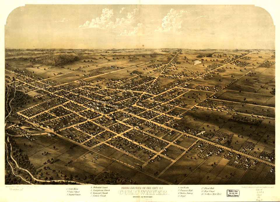
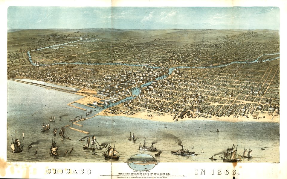
292 Free Images of 1868 Maps
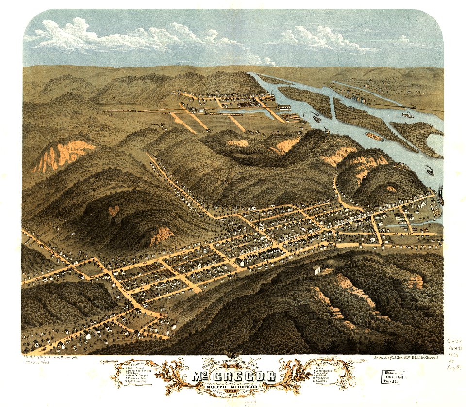
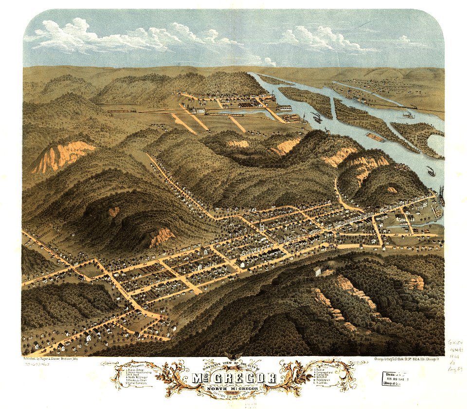
albert ruger
maps in the library of congress
cc-zero
pages with maps
old maps of michigan
1868 maps of iowa
maps from the mechanical curator collection
maps from the mechanical curator collection available to georeference
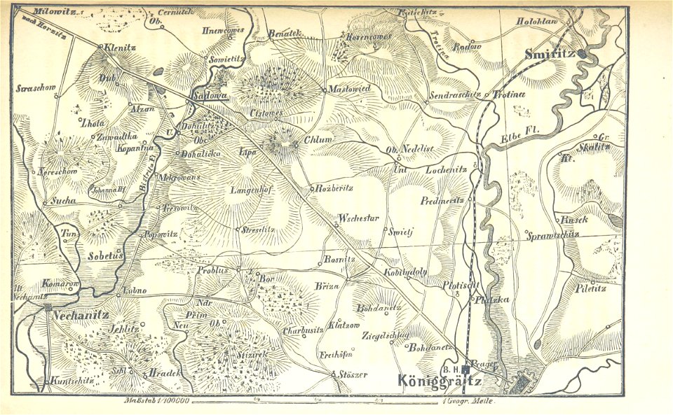
politisch und kriegswissenschaftlich dargestellt (1868) von heinrich blankenburg
der deutsche krieg von 1866. historisch
maps from the earth and its inhabitants, vol. vi
maps indicating exploration
self-published work
pages with maps
maps from the mechanical curator collection
1868 maps
maps by joseph hutchins colton
1868 maps of new jersey
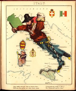
old maps of italy
pictorial maps
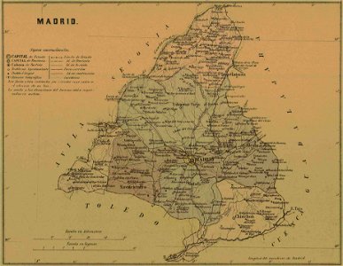
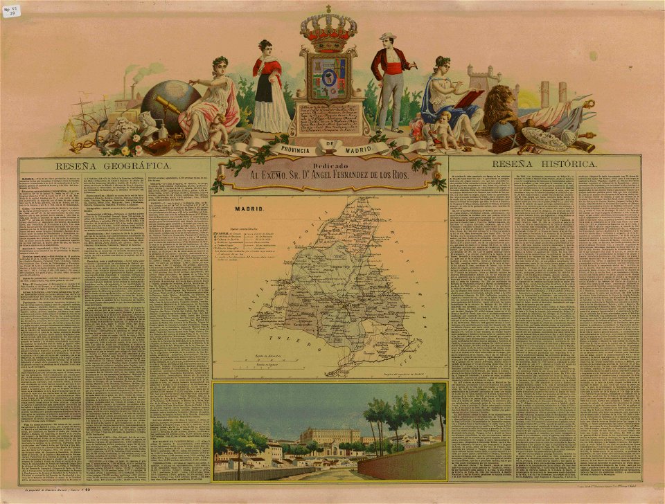
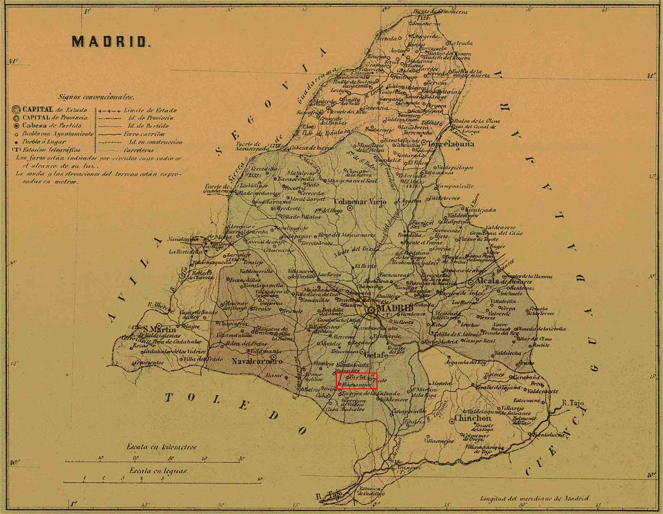
old maps of the community of madrid
1868 maps
maps in the library of congress
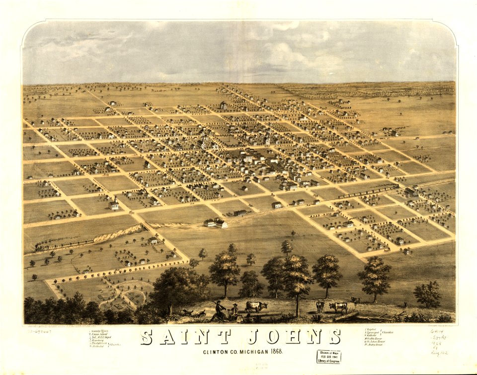
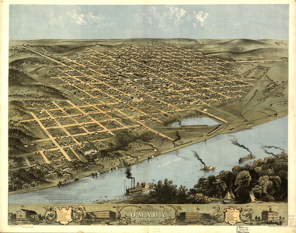
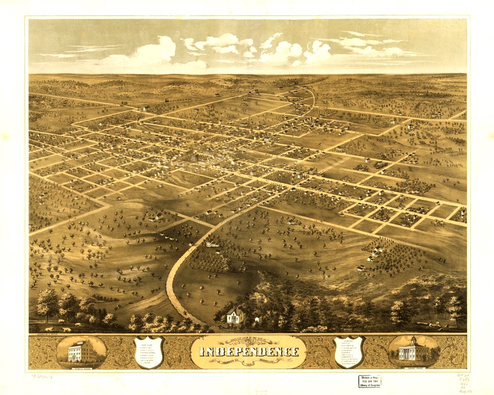
albert ruger
maps in the library of congress
albert ruger
old maps of the community of madrid
1868 maps
maps in the library of congress
albert ruger
maps in the library of congress
albert ruger
maps in the library of congress
albert ruger
maps in the library of congress
albert ruger
maps in the library of congress
albert ruger
maps in the library of congress
albert ruger
maps in the library of congress
albert ruger
maps in the library of congress
albert ruger
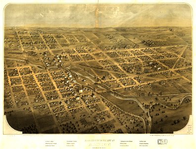
michigan
ionia
michigan
ionia
maps in the library of congress
albert ruger
maps in the library of congress
albert ruger
maps in the library of congress
albert ruger
maps in the library of congress
albert ruger
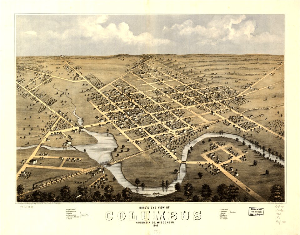
wisconsin
columbus
wisconsin
columbus
maps in the library of congress
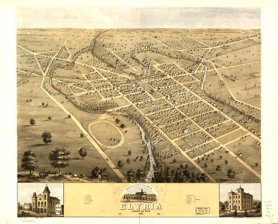
ohio
maps in the library of congress
ohio
maps in the library of congress
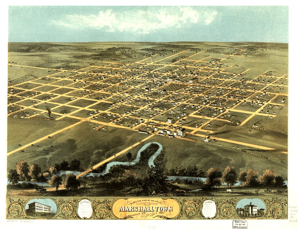
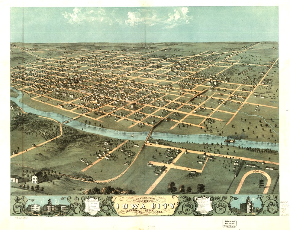
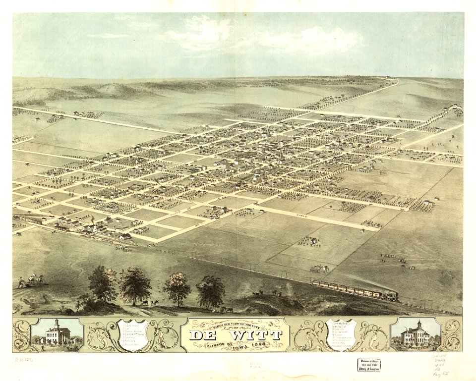
iowa
maps in the library of congress
albert ruger
maps in the library of congress
albert ruger
maps in the library of congress
albert ruger
maps in the library of congress
albert ruger
maps in the library of congress
albert ruger
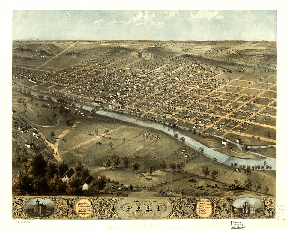
indiana
peru
maps in the library of congress
albert ruger
indiana
peru
maps in the library of congress
albert ruger
maps in the library of congress
albert ruger
maps in the library of congress
albert ruger
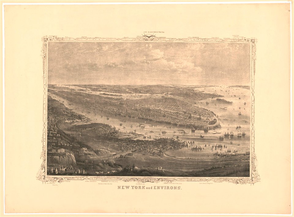
new jersey
hoboken
maps in the library of congress
albert ruger
maps in the library of congress
albert ruger
maps in the library of congress
albert ruger
maps in the library of congress
albert ruger
maps in the library of congress
albert ruger
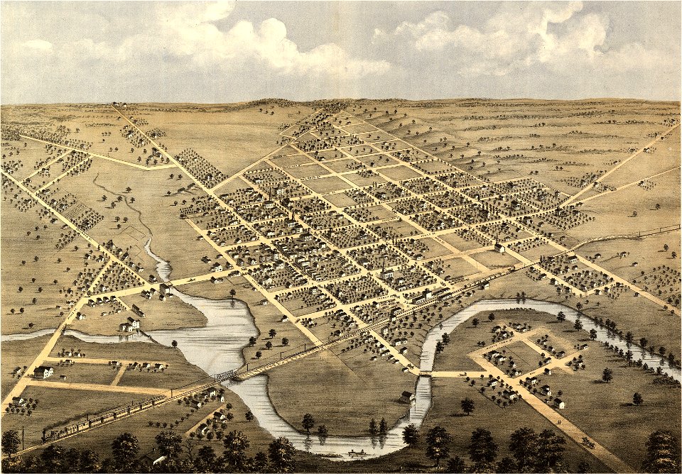
wisconsin
columbus
maps in the library of congress
albert ruger
maps in the library of congress
albert ruger
maps in the library of congress
albert ruger
maps in the library of congress
albert ruger
maps in the library of congress
albert ruger
maps in the library of congress
albert ruger
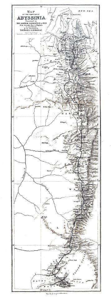
british expedition to abyssinia
henry morton stanley
new jersey
hoboken
new jersey
hoboken
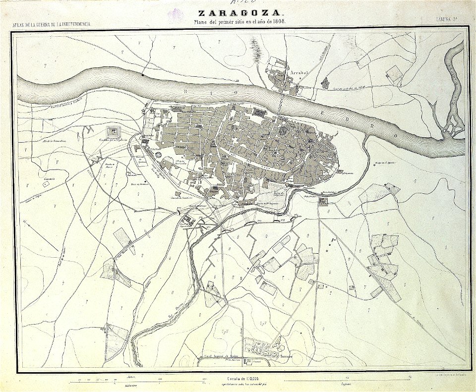
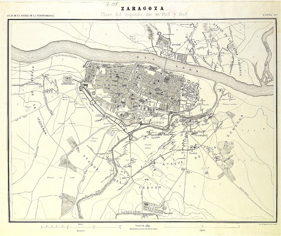
sitio de zaragoza (1808)
1868
maps in the library of congress
albert ruger
maps in the library of congress
albert ruger
second siege of zaragoza
1868
maps of parla
humanejos
maps from the mechanical curator collection
000
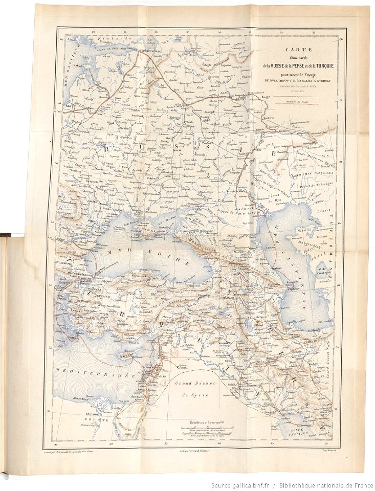
tinco martinus lycklama à nijeholt (1837-1900)
unidentified maps
maps from the mechanical curator collection available to georeference
maps from the mechanical curator collection
maps from the mechanical curator collection available to georeference
maps from the mechanical curator collection
maps from the mechanical curator collection
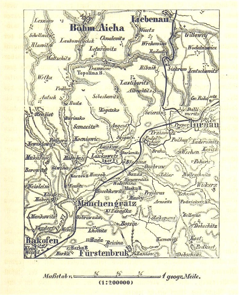
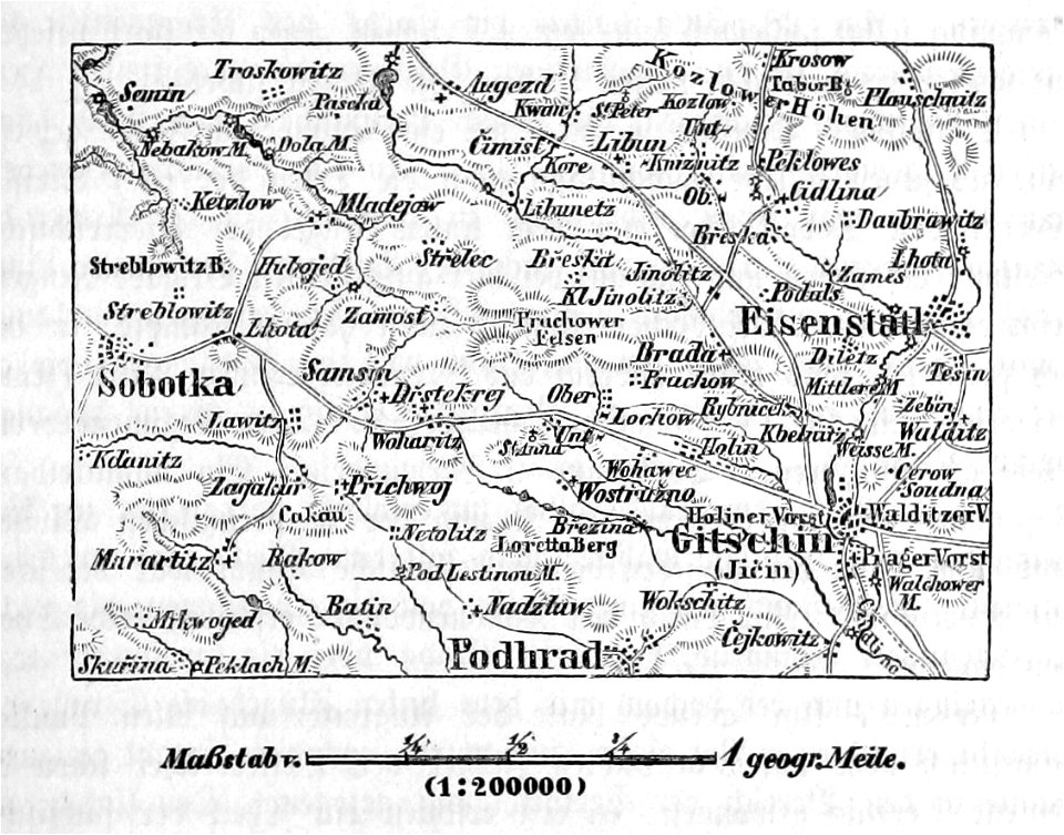
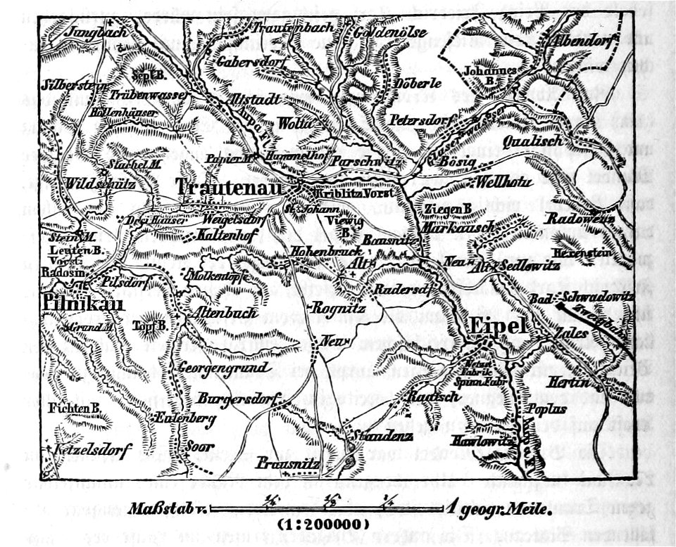
battle of trautenau
maps from the mechanical curator collection available to georeference
maps from the mechanical curator collection
maps from the mechanical curator collection available to georeference
maps from the mechanical curator collection
self-published work
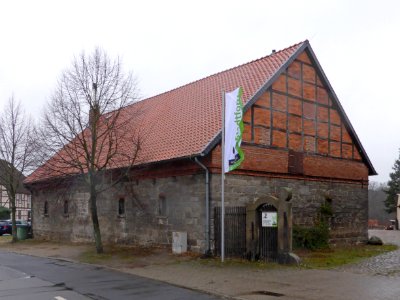
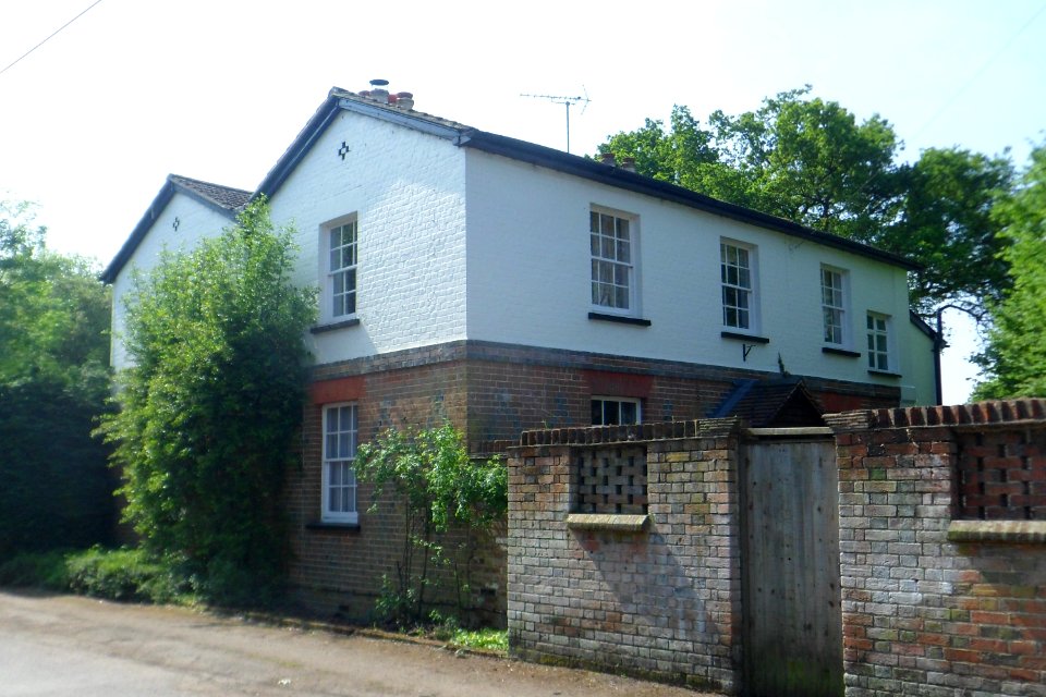
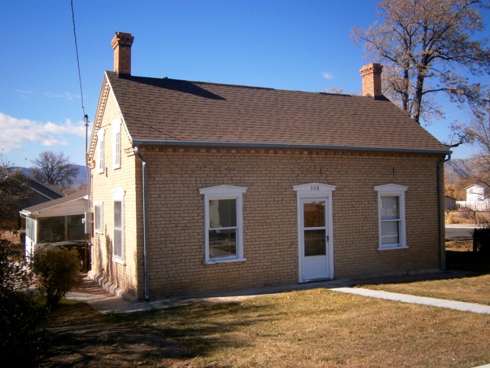
architecture
architecture
village
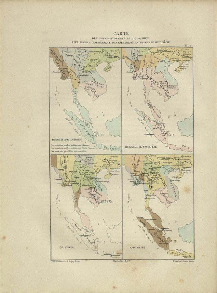
maps of indochina
francis garnier
self-published work
pages with maps
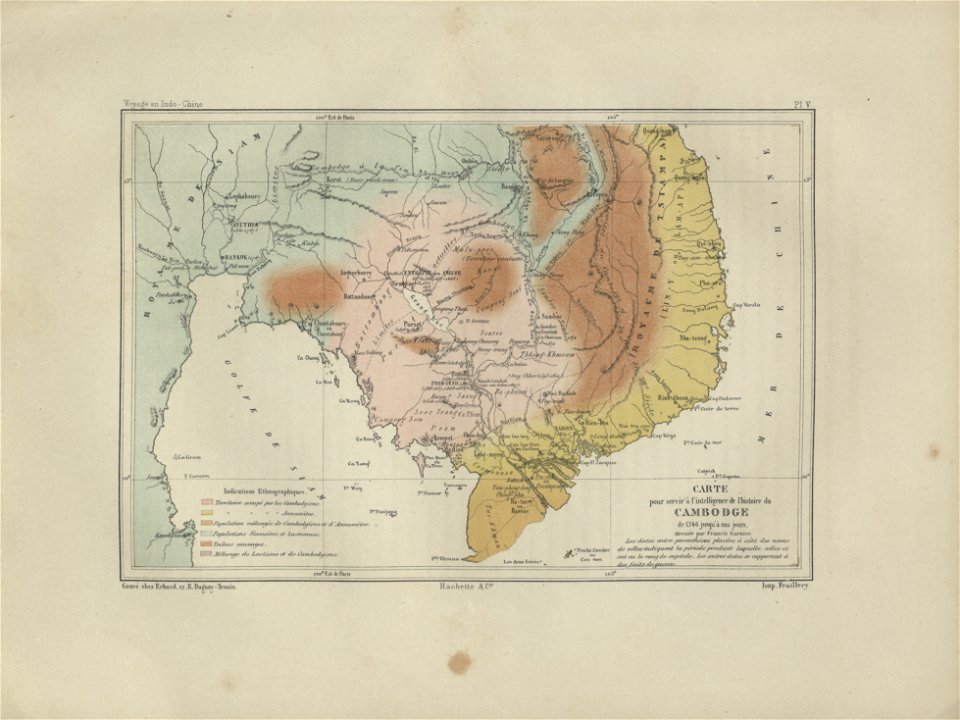
old maps of cambodia
francis garnier
self-published work
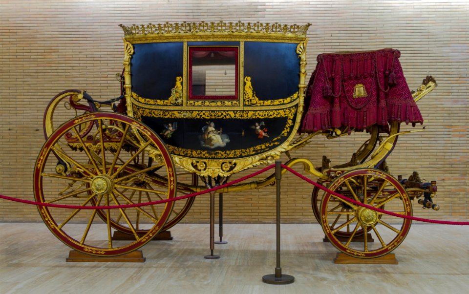
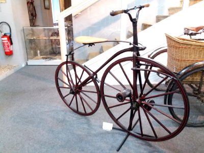
vehicle
pages with maps
cc-zero
self-published work
pages with maps
self-published work
pages with maps
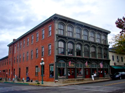
architecture
facade
plate
food
self-published work
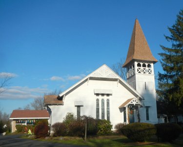
roof
self-published work
july 2020 in paris
village
town
pirbright
town
architecture
city
self-published work
pages with maps
self-published work
pages with maps
bears in art
1868 in art
architecture
village
gemeente atlas van nederland - utrecht
maps of houten
pages with maps
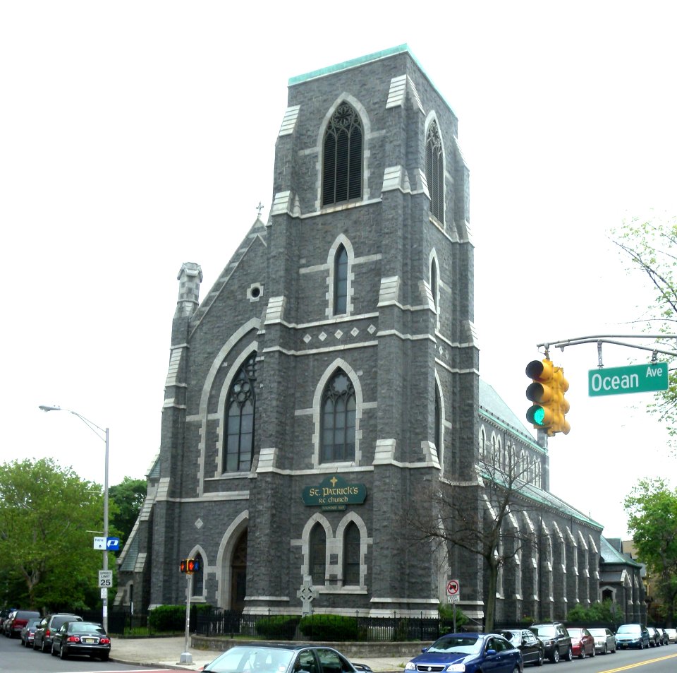
architecture
maps from géographie illustrée de la france et de ses colonies
1868 maps
gemeente atlas van nederland - north brabant
demen
gemeente atlas van nederland - south holland
old maps of dordrecht
gemeente atlas van nederland - north holland
maps of diemen
maps from géographie illustrée de la france et de ses colonies
orientalist painting
gemeente atlas van nederland - north holland
maps of aalsmeer
historical
history
maps from géographie illustrée de la france et de ses colonies
19th-century maps of alpes-maritimes
gemeente atlas van nederland - north brabant
maps of almkerk
maps of hardenberg
avereest
self-published work
roof
1 - 100 of 292
Next page
/ 3